The Streets of Pint Pot Palaces
3rd January 1976
Stoneyholme and Daneshouse, Burnley
Media Ref: BE76ng2979
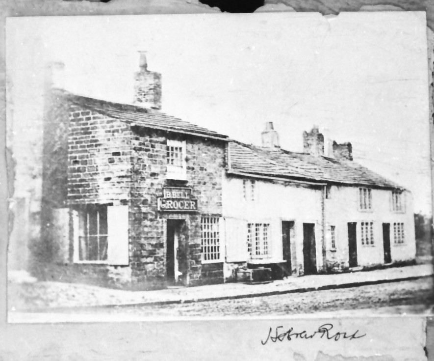







Benjamin Bell's Grocer's Shop on Hebrew Road in approximately 1883. There was a market garden to the rear of the shop to supply produce. In 1890 Bell's Arcade was built in its place (see image BE76ng2979_n).
By Richard Catlow:
Civic Trust members, town planner David Ellis, Padiham artist Duncan Armstrong and myself have been touring the Stoneyholme and Daneshouse areas this week, looking for people or places which are making Burnley a better town in which to live. We selected two of them to receive the Burnley Express "Best of Burnley" awards. Meanwhile I have been taking my own personal look at the area, an account of which follows, and Burnley Express photographers have been capturing the character of the district on film.
The area from Stoneyholme to Heasandford is known as Saxifield, a name which has given rise to speculation that it might have been the site of one of the most decisive battles in English history - between the Saxons and the Danes. What is certain is that it is a battleground today, taking the main onslaught of the council's fight against industrial dereliction and urban blight. The council has already scored a notable triumph on the eastern flank, where the old workings of Bank Hall Pit, which were one of Burnley's biggest eyesores, have been swept away to form the town's newest park. On the west flank the council is finding the going rather tougher. But, through its Stoneyholme general improvement area plan, it is trying to show that old houses in one of Burnley's least fashionable areas can be turned into desirable residences, and for the first time in years, there is new hope. In nearby Daneshouse the fight against blight is largely in the hands of individual residents, and, thanks to the liberal use of stone paint and improvement grants, they are not doing too badly.
The Saxifield area is the opposite side of the coin to Rosehill (featured in the previous 'Manchester Road' article). Factories and houses lie cheek by jowl. Narrow cobbled streets and cramped backyards separate rows of houses. The idea of the builders was to cram as many people as possible into the smallest area. Perhaps unintentionally, they also created a tremendous community spirit: a self-contained world of street corner shops, pubs and churches. It's that much-derided "Coronation Street" image. It was in Cromwell Street that the council fired its first shot in its bid to bring Stoneyholme up to date. About £5000 was spent bringing what was the worst house in the area up to modern standards, and its decoratively-carved stone windows are something you wouldn't get in a modern council house. For widow Mrs Annie Thornber, moving just down the street into the 'new' house was like moving from the past into the future. She left a grim house with damp walls and no bath for a new world of central heating, fitted kitchens and bathroom suites, and believes it is a move that many of her neighbours will be copying. The council hopes so too. Before Mrs Thornber moved in, the house was open to the public. It was hoped that Stoneyholme residents would be so impressed by what they saw that they would make use of improvement grants to do similar work on their own homes.
If it requires an effort of imagination to visualise Stoneyholme as a showpiece residential area, it has to be remembered that the Rectory Road area was once the fashionable home of Burnley's doctors and professional men. Later it was the home of local theatre folk. Council schemes include the demolition of some houses, so that the environment of those remaining can be improved; a big stone-painting area to brighten the area; and open spaces are to be grassed and planted with trees. But the battle to improve the area is by no means over. There was still large areas of rubbish-strewn land, houses which have stood empty for far too long, and decrepit mills that have little hope of ever being used again. March Street sums up the two faces of Stoneyholme. At one end is a group of well-tended allotments, looking both productive and attractive. At the other end is an ugly stockade of old timbers.
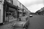
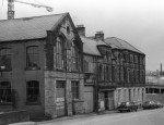
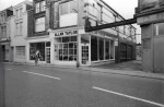
At the heart of Daneshouse is Abel Street, still a thriving shopping area, full of the bustle of life, although some dereliction is evident. At the Hebrew Road end of the street, several shops and houses have been boarded up, and there is an air of decay. The beautifully-appointed gallery of furniture and upholstery dealer Allan Taylor stands out. At the top end of Abel Street, commercial life seems much more vigorous. The houses down the side streets are a kaleidoscope of colour. The residents have been busy stone-painting their homes, brightening up the area a good deal in the process. Virtually all the shops in the area were sited on Abel Street, while the banks, pubs and churches grew up on Colne Road. Now that many of these buildings - both commercial and religious - have been cleaned, this entrance is looking much more attractive. Burnley Lane Baptist Church looks classically imposing, while Colne Road Methodist Church is much more medieval-style, with rose windows and interesting carved-stone heads.
Colne Road is very much a hotch-potch. Newly-landscaped areas, and well-established gardens, dirty buildings and clean ones in a variety of architectural styles. There is even what must be one of the very few brick-built Victorian terraces in Burnley.
By far the oldest in the area is Heasandford House. Parts of it date back to the 13th century; it is one of Burnley's architectural pearls. Yet it is cocooned by ramshackle allotments, old garages and broken-down buildings. No stately drive leads up to its door; instead a dusty track churned up by passing lorries. The house, which is split into three dwellings, is protected by a preservation order.
Another old and attractive building is Royle Lodge, on the edge of Stoneyholme. It was formerly the gatehouse to Royle House, the home of one of the branches of the Towneley family, which was demolished in 1915. Keighley Green Court House is an example of a house which was once attractive. It was built in 1788 by local Methodists. It was their first church and when it was replaced by newer and bigger churches, it became the town's police station and court. Later it was used by members of the Burnley Lad's Club. It's a building which has served Burnley well, but is to be replaced by yet another office block. The court house stands in a pocket of dereliction. The old Forester's Arms has been standing empty for years, and the former Burnley Lads' club is a fire-gutted shell. At the top end of Bank Parade things are much better. An elegant and substantial tow of terraced buildings is one of the best pieces of architecture that Burnley has retained. Now used mainly as offices, Sir James Mackenzie, the famous Burnley doctor and heart specialist, used to live here.
Standish Street is one of Burnley's most thriving shopping areas, from old herbal remedies to the latest in pop records, and enjoy the bustle and colour usually found in country market towns, like Skipton. The street leads up to a world of terraced houses around the inaptly-named Burnley Central Station. Many of the houses have interesting features, like the Moorish-style arched doors of the homes on Newcastle Street. By the station the massive Reindeer and Adelphi Hotels, built for the fast-diminishing breed of railway traveller, are like stranded giants from the age of steam. Diesels and Dr Beeching have signalled their decline, but there must be a chance of their fortunes being reversed if plans to run a tourist-attraction private railway from the station to Bank Hall come to fruition. The proposed line of this narrow-gauge railway is along a strip of land that the council is landscaping, Already a pathway has been laid. Linked by two metal footbridges to the station is a part of Burnley known as the island. And an island it is, ringed by canal and railway. It seems a very close-knit community, and its well-maintained houses set a good example to neighbouring areas.
Winding its way through the Saxifield area is the Leeds and Liverpool Canal, so long the dumping ground for rubbish. How much better things look near Colne Road, where houses and gardens front on to the canal. The canal's character changes even more dramatically past Colne Road. Gone are the views of dereliction, replaced by a piece of real countryside in the heart of the town. For the constantly growing number of people who enter Burnley by canal, this stretch is a great advert for the town. In the future these people in their pleasure craft may be able to longer and enjoy the view, for the council has plans to build a marina at Bank Hall. British Waterways has mounted a massive clean-up, dredging the waters of huge amounts of rubbish and tidying up the tow-path, which has been declared a public footpath. All in all, Burnley can be proud of the progress the canal is making. It signposts the way to a greener and better future for the town.